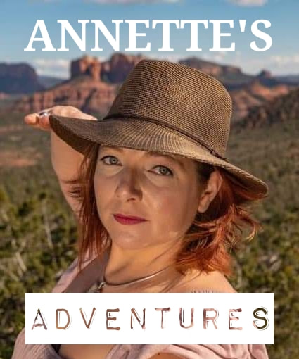
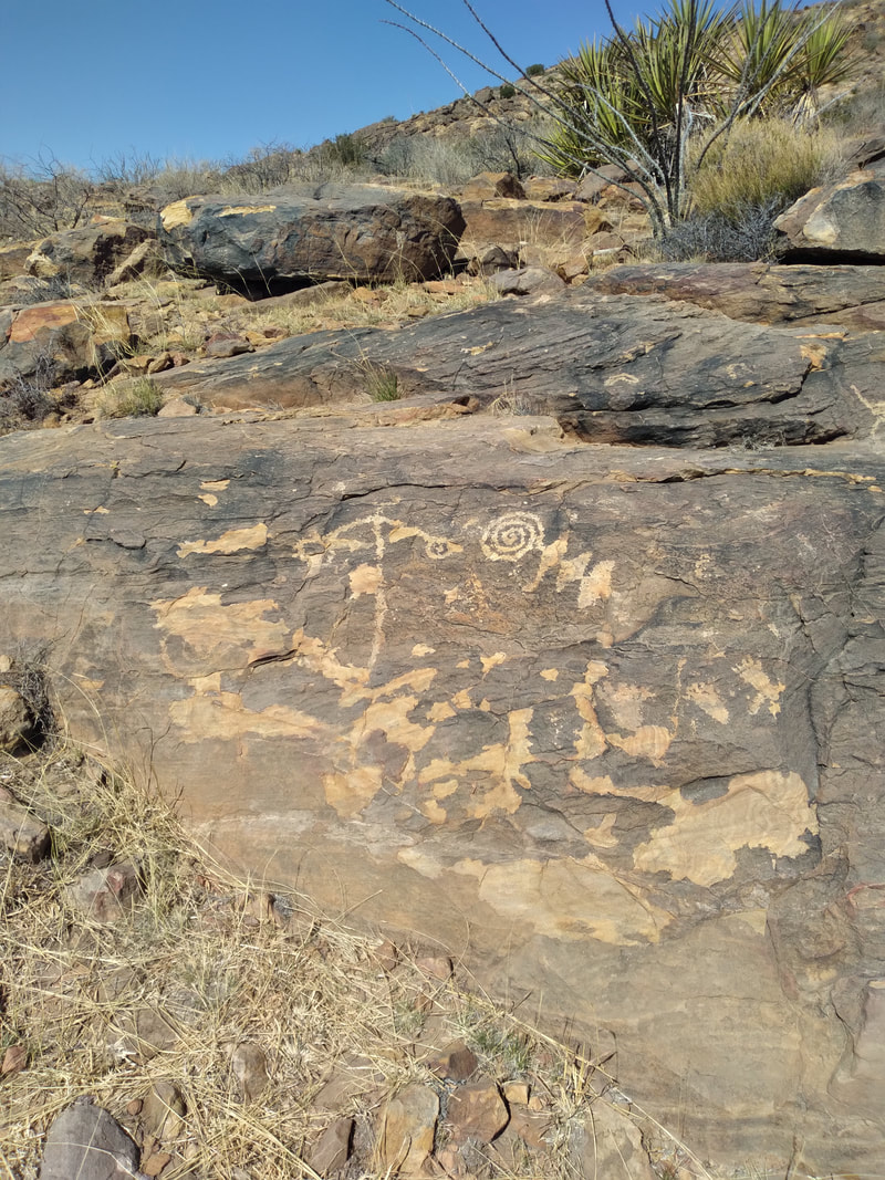
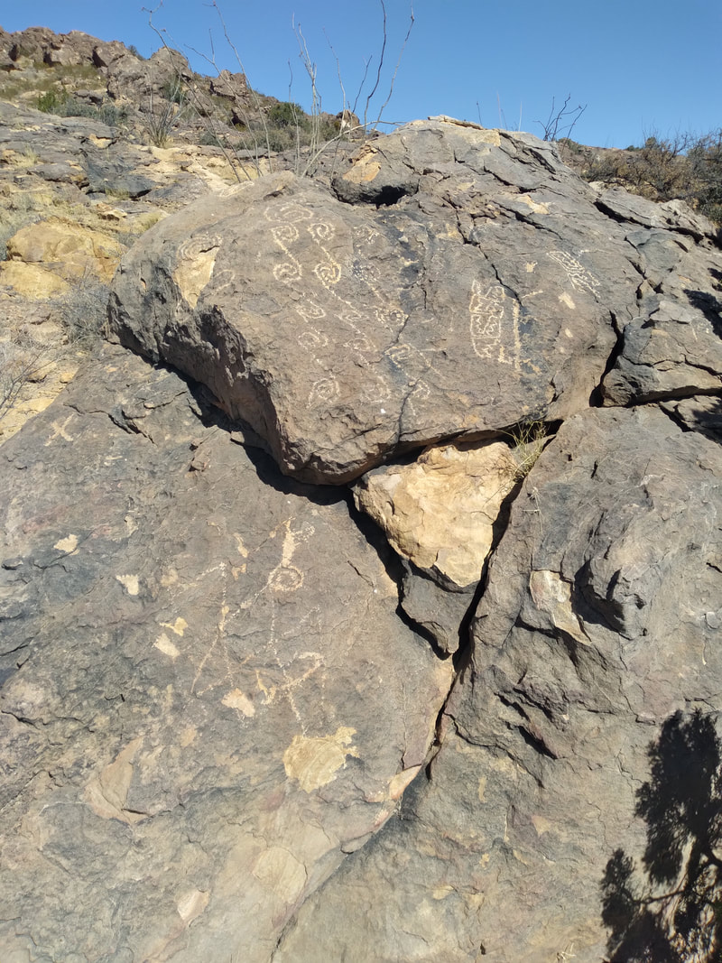
 Hi Folks! Welcome to a long-overdue episode of Annette's Adventures! I've been working in the Cookes Peak Mining District, located northeast of Deming, NM. The mining district encompasses three historic mining camps, Hadley Town, Cookes Town, and Jose Town. It is situated in Cookes Range, a rugged and remote mountain range centered around Cookes peak, which towers above the surrounding desert at 8,408 feet. My introduction to Cookes was one that I am not likely to forget but will reserve for another day. The results of such an introduction allowed me to meet the locals and learn the local lore and the routes they use to get around the region 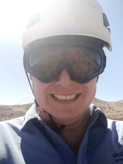 One of such opportunities was a trip to Fort Cummings to show me the eastern entrance to Cookes Canyon, at which time I was told the canyon was the "Original 'Masacare Canyon'" and that this was the route that I should take to get to my field area. I would need to find the western entrance to the canyon. Following my guided tour of the region, I found out that the west entrance to the canyon was the first left after the second cattle guard. I immediately set out to find the west side of the canyon and travel through the canyon to the old spring house. The first day after my introduction to the area, I took an off-road trail from the RV through a dry wash to a dirt road. I follow the dirt road to a secondary road that leads me to the canyon pass. On my first trip along this route, I noticed a small sign designating a parking spot in a seemingly odd location. I drove past the parking spot a small distance and saw large panels of petroglyphs on the hillside. I quickly realized that the parking spot was for the petroglyphs, so I backed down the road, parked LadyBug, and scampered up the hill to the petroglyphs. Standing on the hillside next to the petroglyphs put me in a state of awe. I looked around the surrounding area and thought about those there first and the type of life they might have lived. After my awe-inspiring moments taking in the petroglyphs, I scrambled back down to LadyBug and continued my journey along the route. The road skirts around the valley floor from the petroglyphs. It climbs above the valley, passes through a saddle, and follows a gorge out the other side through a narrow valley to Fort Cumings. Once at the fort, I went to the spring house and read the plaque designating the spring as a part of the original Mormon battalion route and later the Butterfield stage route. I explored the few remaining buildings near the spring before returning through Cookes Canyon back to camp. As I drove back through the pass, I felt the eyes of hundreds of Indians staring at me from the surrounding ridges. I kept a watchful eye on the hills, but the only silhouettes I saw were rocks and bushes. That first trip through Cookes Canyon ignited my curiosity about the area's history, and I started listening to the stories of longtime residents. One person told me that naturally occurring lead contaminated the Cookes town spring and that if you visited the cemetery, you would notice a substantial amount of children. The storyteller continued to tell me that occasionally one of the miners would succumb to the lead poisoning and go on a rampage through town. Cookes Spring was named for Captain Phillip St George Cooke 2nd U.S. Dragoons, former commander of the Mormon Battalion whose forward scouts discovered the spring in 1846. The spring was the only freshwater supply between Mesilla and the Mimbres River, and the nearby pass became a popular overland route. By 1858 the spring and nearby pass became part of the Butterfield Overland Route and an established mail station. The mail station became Fort Cumings in 1863 and closed in 1873. The fort was again used from 1880 to 1886 as a camp during operations against the Apache. At the height of operations, Fort Cumings included a parade ground, corral, and several adobe buildings that were all encompassed in a 10-foot tall adobe wall. At the time, this was the only walled fort in New Mexico. Amazingly the spring house stands intact after all these years, but all that remains of the fort is some walls melting back into the desert and a graveyard. One book I found recounting stories from Fort Cumings described Cookes Canyon as a"'journey of death'" six miles or more in length and a gloomy gorge of four miles to add to its terrors." The author continues, "The tales of this gorge in the sixties where so many massacres were perpetrated by the Indians were gruesome enough." One such incident is the 'Battle of Cookes Canyon,' which tells of the Acke Party, a large group of refugees from Arizona heading east to Mesilla. As the last wagon entered the canyon, approximately 100 Apaches ambushed the group. The last wagon in the group was able to flee and returned to Mimbres, where they sent a plea for help from the Arizona Guards stationed at Pinos Altos. The ambush took the lives of 4 individuals and wounded many more. This incident sparked a series of skirmishes between the settlers and the Apache. One account says that the Arizona Gaurd recovered some cattle, and the sheep were later found in a side canyon not too far from the fighting. I've safely passed through Cookes Canyon many times to Cookes Peak. Each time I pass through, I am struck by the beauty and the ruggedness of the terrain. I imagine life in the west during the pioneer days, and the thought of traveling this route with a wagon instills me with great respect for the pioneers of the old southwest and the Apache that came before. Until next time readers, thank you for joining another one of my adventures! ***Annette is a trained and experienced Field Geologist. Please be cautious and always keep out of any abandoned mining area. Safety First!***
Growing up in an active family, I was accustomed to being outdoors. My family played many different games on the trails and at the campgrounds. My parents used every opportunity to teach us how to thrive in the natural world. It wasn't until I was older that I understood that the depth and breadth of my outdoor experiences exceeded the average city dweller. Some parents find ways to sneak vegetables into their children's food; my parents found ways to sneak survival into our hikes and camping trips. My favorite campground game was and still is "Gourd Ball," it is similar to bocce in that it is played with a "p," small rock or something that is the target. Instead of bocce balls, we would use gourds, and instead of a court, we would use the entire campground. Whoever was closest to the p would get to throw it for the next round; they could throw it anywhere they liked. Our games usually wound through the campground, twisting and turning through empty campsites and along the roadways. Eventually, we would find ourselves far away from camp, and it was up to us, the children, to successfully navigate our way back to camp. That game taught me to pay attention to my surroundings while still having fun. I still find myself noting landmarks, not just in front of me but also turning around and noting what boulders or snags I should look for on my way back. We would play a game we called "G.I. Joe" on the hiking trails, based on our favorite Sunday morning cartoon, of course. Each person would pick their character to play, and we could come up with scenarios that required us to find solutions. A lot of the game motivated us to move faster on the trail and probably farther than we wanted to. When we stopped for lunch, we would run around and save the world from evildoers. At the end of it all, when we were tired and ready to collapse, we would end the game with our favorite tag line, "knowing is half the battle." Of course, that wouldn't be the end of it. We still had to hike back to the van. With all the games my family played, I never knew there was a set of equipment called the 10 Essentials. It wasn't until I was older that I learned about the 10 Essentials, but ironically enough, I always had the ten packed. I remember the day that I felt a responsibility to trail safety. It was the day after a group of my friends, and I hiked a trail in Montecito. The trail went through a steep-walled canyon and ended at a dry waterfall. We used trees along the trail to pull ourselves up the most vertical sections. We laughed and played all the way up and down the trail, teasing each other and playing silly games. The following day I read about a fatality on the trail; it happened the same day we were up there goofing off. Two high-school-aged kids were on the trail after sunset and got caught in the dark. Their cell phone flashlights were not enough. One was rescued the following day and sent to the hospital, and the other was recovered later that afternoon. My heart broke when I heard the news. I talked about it with one of the professors on campus, and we both decided we had to do what we could to impart some survival skills to the students who never had the opportunity to learn. That was the day we started the "Adventure Club" at Ventura Community College. Our mission was to give outdoor skills and experience to students that previously lacked the opportunity. We set up weekly meetings for the club and invited everyone we knew. We let the members choose what they wanted to learn. We asked them to take turns researching and presenting survival skills and outdoor ethics to the club. And we organized monthly outings to give them a chance to practice what they learned. Through the Adventure Club, I first learned about the Ten Essentials and the many different ways to wrap an ankle. As with most small campus clubs, the Adventure Club has faded out of existence, but at least we helped a few students be better prepared for life's adventures. 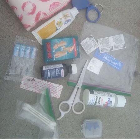 Annette's Safety Basics This blog is an introduction to a series of blogs where I will be focusing on safety. In this series, I will be sharing safety kits from my friends and people I meet along the way. I will include the stories behind why they have certain items in their safety kits with the hope that by the end of this series you will be motivated to create your own trail safety kit. Pictures included with this blog are a sampling of safety kits that I came across over the holidays. I met a kind gentleman with an overland rig that was very happy to let me take pictures of the safety kit for his overland rig. My great friend Alicyn Gitlin was gracious enough to share her kit with me, and I’ve included my very small backpack basics kit. May your new year bring many fun adventures and safe returns. Hello Adventurers, Welcome back to another edition of Annette's Adventures! I am back working in the Cerrillos Hills, one of my favorite locations to work. This time, I am three gates deep into private property and loving every minute of my workday. Getting access to the area that I am working in requires coordinated access permission from multiple people. Once permission was granted and the keys were picked up, I drove out to scout the roads and plan my workdays. I know the road as far as the gates and a little ways past the last gate, but I have never been all the way out the road. My first mission was to see how far out the road I could drive. I drove out farther than I expected, but not as far as I had hoped. Once turned around and parked, I started traversing the hills, but I had forgotten to update the data on my GPS unit, so it was indeed just a scouting day. 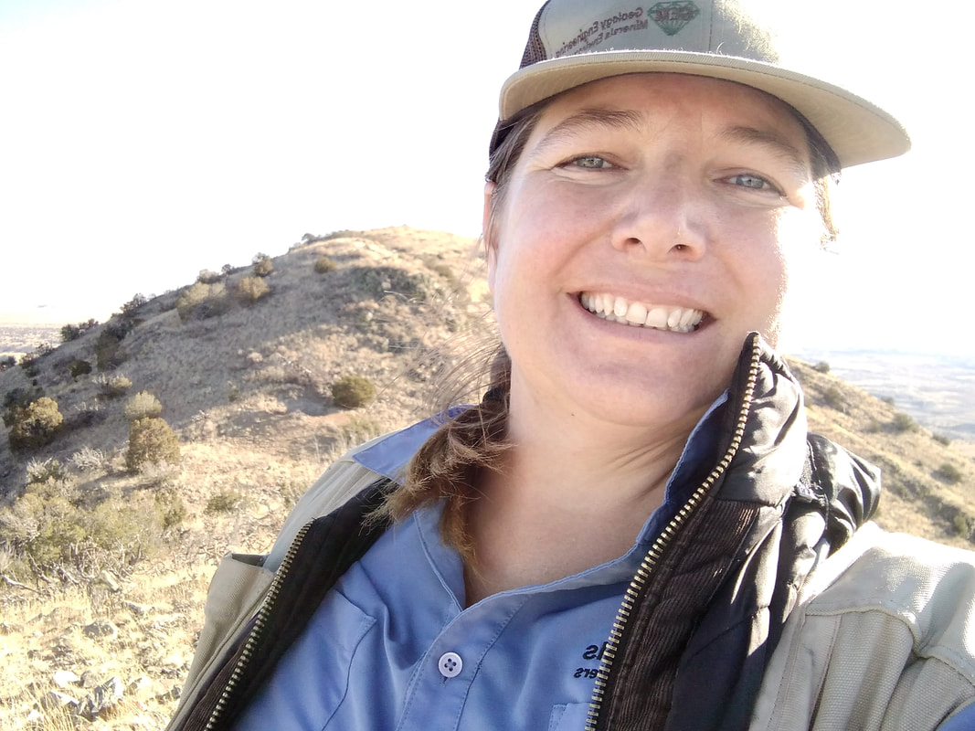 I returned to Cerrillos Monday morning, ready and excited for a full day of work. My goal was to reach the top of the central mountain and record monitoring data on my way up. I started in the hills, moving up the mountain's eastern flank with each feature that I monitored. The day was still and peaceful. There was a slight breeze and a little nip in the air, but the sun was warm, and I quickly traded my thermal for my go-to field shirt. I carefully picked my way through the cactus as I climbed the hillside. Each feature I came across was slightly higher than the last, and each time the slope flattened out, I would take a break from walking to enjoy the view. The higher I climbed, the steeper the terrain got and the closer the cactus grew together. At one point, I had to stop and ask myself if the risk was worth the reward. The slope was steep, the rocks were loose, and cactus carpeted my path. I continued to the top, knowing that there must be features at the top. There are always features at the top. My responsibility is to make sure that I check them for safety, regardless of how difficult they are to access. I eventually reached the top of the mountain. The slight breeze that gently kept me cool in the lower elevations had turned into a full-blown wind. The temperature had dropped, and the sun was lower on the horizon than I had hoped it would be. But that was all ok because I made it to the top, and there really were mine features up there. I proceeded to the features, recorded their current state, took the required pictures, and then crept to the edge of the north slope to plan my route down. I knew there were features below me, but I didn't know where. I knew that I didn't want to leave them for a future day, but I didn't know if I could safely reach them. I took a few minutes to prepare for my descent: I pulled my thermal on over my field shirt, studied the GPS unit, and tucked it into the back pocket of my vest. I pulled my gloves on and slowly started to make my way down the north flank of the mountain. Thankfully my trajectory was spot on. I quickly saw the first of the 3 intended features; it was directly below me. Knowing that it is not safe to walk straight downhill to a feature, I changed my path and moved to the west before proceeding downhill. As with the climb up, I was making my way across loose rock through fields of cactus. I picked my way carefully and grabbed onto juniper branches when available to help ease my mind. Once at the mine feature, I recorded my observations in the GPS unit and started to plan my route to the next and final feature of the day. The last and final feature of the day was a bit higher on the slope and somewhere east of my current position. I planned it that way to get that feature on my way back to the truck, but I was unaware of the slope conditions when I made my plan. No turning back now, and there is no way I wanted to climb back up at a later date, so I very carefully picked my way to the last mine feature of my day. With the last feature completed, I had to make a decision. Do I make my way downhill and then cross the many hills to get back to the truck? Or, do I cross the slope and make my way down the eastern flank as previously planned? I decided to stay high on the hill, but I knew it would take decisive foot placement. I made my way to the east and then carefully downhill. Every step was a careful judgment call. Are there any loose rocks? Are there and cactus? Is the slope stable? Is it safe to stop there? All the while keeping an eye on my trajectory, I was aiming for a specific spot on the hill that would give me a more clear view of my route out. Once there, I again started down that slope, very carefully picking my way through the carpet of cactus. I was walking in the shadow of the mountain and would remain in the shadow for the rest of my hike out. I knew I wanted to get back to the truck with as much daylight left as possible. As the slope graduated from too steep to climb to a pleasant hill, I quickened my pace. I made it back to the truck at 4:54, three minutes before the official sunset, and quickly sent a text to HQ confirming my safe return. What started as a blissful morning traversing the hills turned into a great accomplishment. Not only did I climb the mountain, but I did it safely and without injury. I started my day thinking thoughts of gratitude, specifically for such a peaceful day and for having a career that allows me moments of happiness in beautiful locations. I finished my day thankful for my skills and abilities and the gear and equipment that kept me safe. Every year on Thanksgiving, I ask everyone at the table to say what they are most thankful for. This year I am grateful for so much, I won't begin to list everything, but most of all, I am thankful for the support of the great folks at GEM Environmental. This has been a fantastic year, and I am looking forward to many more adventures and many more safe returns....
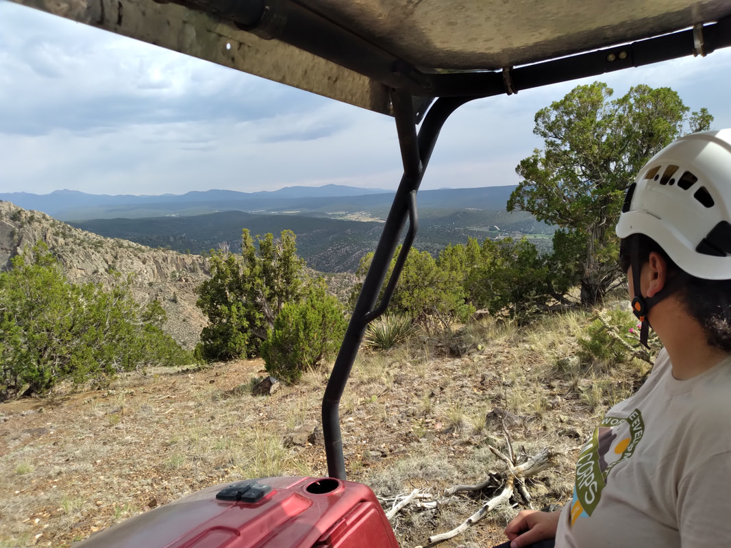
Welcome back to Annette's Adventures! While Annette has been on time and active with her adventures, I (Marlena- the editor) have been backed up and behind and I formally apologize for the delay! Without further ado, here is Annette's October Adventure... 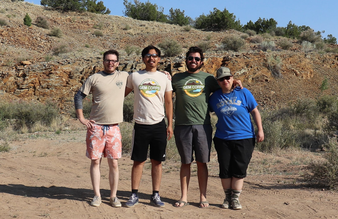 Hello adventurers! Welcome to Annette’s Adventures. I spent most of this last spring monitoring the Cerrillos Hills; I’ve tried not to bore you with all the details, but it is, by far, my favorite place to work. You can read about my introduction to Cerrillos Hills and AML monitoring in my blog from March. Today I am going to take you back to Cerrillos Hills with the summer intern crew. GEM Corps arranged for the interns to meet with AML Administrators from State and Federal agencies in the Cerrillos Hills, for a walking-talking tour of mine closures. Our day started at the State Park Headquarters in the village of Cerrillos. We met with the administrators and listened while they gave the group some background on Abandoned Mine Lands and the mine closure efforts in the Cerrillos Hills. From there, we went to a trailhead and walked to some closures in the state park. We started with one closure: an old mine shaft covered with wire mesh and a bridge that allows you to safely walk over the mine shaft. We talked about the anatomy of the mesh closures and the engineering behind them. Then we talked about what type of degradation to look for when monitoring closures. We walked to a second nearby closure, where we looked at how the mesh is anchored into the ground and looked for signs of degradation. From those two closures, we walked back to our vehicles and drove to some harder-to-access closures. We visited some “puff closures,” backfills, and the second type of mesh closure. The administrators explained the engineering that goes into the different closures and the typical kinds of degradation at each closure type. They also told us some stories from their learning experiences in implementing the different types of closures. The AML Administrators finished the tour by taking us to some of the oldest mine features in the area. We visited the Mina Del Tiro and Bethsheba mines on our way to the oldest known turquoise “pit” in the area, Mount Chalchihuitl (CHAL CHEE WEE TE). Mina Del Tiro is known as the oldest recorded metal mine in North America. Bethsheba’s claim to fame is that it is the most studied lead mine in North America. Both mines are remarkable for their age, depth, and history. 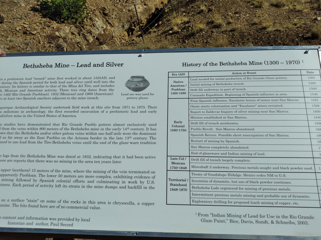 Of all the stops in the tour, Chalcihuitl was the only feature that I had not previously monitored. As such was a special surprise for me. My first impression of the diggings at Chalchihuitl was one of awe and reverence. For me, it was a humbling experience, the idea that this space was held in reverence for thousands of years and countless generations. I noticed that voices were a bit hushed, eyes were wide open, everyone stood around taking in the atmosphere. Our trip to the Cerrillos Hills didn’t last long. Still, the experience will last a lifetime. I’ll be working in the area this winter and look forward to exploring Chalchihuitl and the surrounding area more. Til next time, my friends and followers…. Hi, friends. Welcome to another edition of Annette’s Adventures. I’ve written a lot about my adventures in the field, exploring the rocks and mountains of New Mexico, but today I decided that I wanted to share an urban adventure with all of you. Did you know that New Mexico is possibly home to the oldest apple tree in North America? Let’s start with a bit of history before I get into the adventures.  The Spanish arrived in New Mexico around 1598, but people were farming the middle Rio Grande Valley as early as 1200 – 1300 AD. Spanish Colonists established farms and ranches all along the Rio Grande and planted apples throughout the region. The Pueblo Revolt occurred in 1680 and drove the Spaniards out of the area until they returned in 1706 and established more permanent settlements. La Villa de Albuquerque became the administrative and trading center for the surrounding area. Agricultural settlements sprung up around the Villa; each settlement developed a unique community identity that still stands today. The Manzano Mountains are a small, north-south trending mountain chain located approximately southwest of Albuquerque. In 1926, the Manzano Forest Reserve identified a tree near the Manzano Mountains that is believed to have been planted before 1676, making that the oldest apple tree in North America. So, what does this apple history of New Mexico have to do with Annette’s Adventures? Everything! My New Mexico harvesting adventures started this summer. I kept in trail-ready condition for fieldwork by hiking on the weekends. When it got hot, my friend and I started hiking in the Santa Fe Ski Basin; we could escape the heat and get some high elevation hikes in. One weekend a lady on the trail gave me two mushrooms. I took them to the field and shared them with the crew. They were delicious! After that, I was hooked. I took a basket and mushroom field guide to the mountains every weekend for a month straight. It is important to note that I only picked mushrooms that I could positively identify as bolete and sought out mushroom mentors whenever possible. A friend recently introduced me to a local group of volunteers called Food Is Free ABQ (FIFABQ). We joined FIFABQ for a harvest at a micro-orchard in Los Ranchos. The orchard is considered original; it was repurposed as a central park for a small townhouse community. There are about 30 trees in this specific micro-orchard, most were apples, but there were also pear and Asian pear trees. In two hours, the group harvested roughly 2,400 pounds of fruit. The fruit gets distributed to local people who can use it. As a harvester, I came home with an unexpected grocery bag of apples. My first harvest was a blast, and I got apples too! No surprise that I would jump in and help with more harvests. The second harvest I joined was only two miles away from my house and was again an old established micro-orchard. FIFABQ is an all-around win when it comes to community service. Harvest season continues through November, and I look forward to volunteering with Food Is Free Albuquerque again The adventure doesn’t stop there. The apple harvests is a great way to connect with and learn from locals. I made a small comment about how beautiful and tantalizing the prickly pears look, this led to me learning how to process the ruby red fruit. Filled with curiosity and armed with leather gloves, tongs, and paper bags; I harvested my first batch of prickly pears. My cupboards are filling with local harvest, who knows what fruit I will harvest next, but it will likely produce many tasty treats. Until next time my friends…. 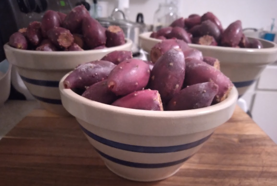 Hello Friends! Welcome to another story from Annette’s Adventures. Today we are going back to northern New Mexico and the Picuris Mining District... 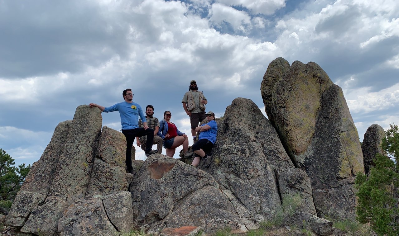 We arrived just before sunset and searched for a place to set up camp. After some deliberation and muddy road driving, we settled on a campsite and made our temporary home. The next day, as is customary, we took the ranger out for some dirt road reconnaissance. We drove around the roads for most of the day, looking for connecting routes and mine features. With the dirt roads behind us and general knowledge of the terrain, we stopped for lunch. Our lunch location was, of course, set amongst mine features. After scampering around the hillside, we returned to camp and started planning the next few days of work. The goal for the following two days was to focus on monitoring the Harding Mine. You may remember from my last adventure that, try as I might, equipment failure was inevitable. I had to return home with only one piece of data. This trip, I was determined to rectify that. I also wanted to find the elusive “Iceberg”! Iceberg, what is Iceberg? Why is it marked on the map? Why does it say “Icelandic Spar”? Is there Icelandic Spar here in northern New Mexico? Why did they put it on the map but not talk about it? I had so many questions. The only way to answer my questions was to hike hills and see what I could find. We arrived at Harding and went straight to the top of North Knob. I like to start at North Knob because it gives you a sense of the whole operation. But it is not until you are down on the ground that you get a sense of the beauty. I quickly separated from the group and started making my way around the mine features. I hiked down North Knob towards the west and found a couple of trenches on the side of the hill, marked them, and moved on. I chased down a couple of prospect pits out in the flats and decided to turn my focus back to the mine complex. I circled my way back to the mine through the large “waste rock” piles and climbed up the hill to a shiny new-looking fence. A collapse, good thing the undercuttings below were closed. I made my way back around the face of the underground workings, where all the closures are, and slowly worked my way back to the group. When we went back to Harding the following day, I had an ominous feeling that I couldn’t shake. My job is to ensure the safety of mine closures. If there is one collapse, then there could be a second. How would I know? I had to walk to the hill. I had to put boots on the ground and hike every inch of that hill. I again left the group and started hiking. I traversed the hill multiple times, keeping my head moving. I looked for any sign that I could see that would suggest giant gaping holes. After a thorough inspection and no sign of impending collapse, I decided to move on. I found a well-worn trail on the southwestern slope of the hill. It was an odd trail that went around the backside and away from the mine workings. I followed the path to see where it would go. While rounding a corner, that’s when I saw it; little ice cubes all over the ground. It must have been close to 90 degrees that day, I knew it couldn’t be ice! I found Iceberg! My mind was so focused on the safety of the complex that Iceberg had slipped my mind. I kept walking, with my eyes on the ground, and the pieces grew in size. I eventually called it in on my radio, “I FOUND ICEBERG!” and then promptly sat down to play with the pebbles. The pit was nothing special. It was a hole in the side of the hill, about the size of a minivan. I hung out at the pit for a few minutes and enjoyed the pretty pebbles while eating my sandwich. Eventually I pried myself from the rocks, but only so long as it took to find the rest of my group and bring them back. Finding Iceberg and solving my fun little mystery was the perfect way to end our day and make our way back to camp…  Hello friends, and welcome back to Annette's Adventures! This week I will take you along on what turned out to be a scouting trip to the Harding Pegmatite Mine in the Picuris Mining District. The Picuris Mining District lies between the small village of Dixon and the Picuris Pueblo. The mine features stretch from south of the Embudo Creek to the north of Copper Hill. Harding Pegmatite Mine is on private property; it is owned and managed by the University of New Mexico. My trip started as most outings do, packing the truck and getting on the road. We (my field partner Jessica and I) left early in the morning and drove north from Albuquerque. We stopped in Espanola to fill up the gas tank and headed east. We turned right on HWY 75, turned right down a dirt road, and arrived at the gate for Harding Pegmatite Mine. Upon arrival, we saw some people getting ready to walk into the mine, so we stopped and introduced ourselves. They were a kind couple from Ohio. We chatted with them about the different mines they have seen on their trip. I told them about a couple more mines they might want to check out before the end of their vacation. Then we parked the truck, unloaded Lady Bug, and got ready to explore/scout/see what the land had to offer. We were there on official business, monitoring, and as such, our goal was to verify the safety of the closures. The secondary purpose of the trip was to help my field partner get experience using the GPS device. Thirdly, the excursion also served as scouting for the next field campaign. I knew going into this trip that my data was skewed, but that did not bother me. I can usually read data from a separate GPS unit and input correct data into the unit that I use. I asked my field partner to use her GPS unit to read information to me. I could input the data into my GPS unit as a new point. We had three GPS units with us. Mine had skewed data, one could not connect to satellites, and a third unit that was unresponsive. SO, here I am, in the field with three broken GPS units and no way to work. We managed to document one point on my GPS unit before realizing that there was a lot of data missing from her unit. We walked around the site a bit and then decided to change the plan for our day and scout the roads. We hiked back to Lady Bug and drove around looking for mine features. We eventually found two pits overlooking the Penasco river and used that opportunity to take in the view and some pictures. All through the day, we were commenting on the likelihood of rain at our location. We watched the sky. Clouds were moving about, we saw rain, but each dripping cloud seemed to move away from us instead of towards us. My field partner and I are notorious for not setting up tents, but I decided that with such unpredictable weather, I would set mine. My partner did not pack her tent. In place of a tent, I made a make-shift bed in the back seat of Pegi for her. I piled boxes and bags in the footwell of the back seat and covered the whole thing with my yoga mat. I told her that I hoped she did not need it, but it was there just in case. She set up her cot near a tree, and we went to bed. Sometime during the night, I hear the tapping of rain on my tent. When I woke in the morning, her cot was empty, and I knew she had found her way into the back seat of Pegi. I am notorious for having poor cell phone reception in the field. It surprised me when a string of messages started dinging into my phone at 7:30 that morning. A few were from friends, but what surprised me was a text from a BLM employee telling me that he had the corrected data I needed to work. He was on his way to Taos and would meet me along the way to deliver the data. Well, that changes everything (again). He called just as I was typing my response. We settled on a meeting location and time. I shared the new information with my field partner, and we got to the business of packing camp. We had some difficulty loading Lady Bug onto the back of Pegi, but with the assistance of a local that was out riding his bike, we managed to load Lady Bug and drive off. Except, we were late. The person we were to meet waited as long as he could, but we missed him at the meeting spot. We did not know that we missed him, so we waited for an hour and decided to drive to Taos and get the data from him there. Once in Taos, we went straight to the BLM field office. Our contact person was in a meeting, but he managed to hand off the thumb drive to someone for us. Once outside, I made a quick call to thank our tech guru for all her efforts, then told her that we would set up at the local park to fix our technology. With correct data in place and two out of three units operating as they should, I reached out to my BLM contact person and asked if I could return his thumb drive. As it turned out, he was having lunch across the street. We walked over and talked about what we saw at the Harding Mine. He informed us of more areas that could benefit from our attention and thanked us for our work. After chatting for probably too long, we left him to his lunch and drove the long way around Taos to enjoy the views. We went over the Taos Gorge Bridge, headed south, and crossed the river again at Taos Junction Bridge. We took advantage of the drive and the views to watch the weather. I saw lightning above the mountains we were supposed to work next and decided that it was probably safer to head home and come back another time. The drive home, was of course, not without its adventure. The kind couple from the mine talked about Blue Heron Brewing and the delicious beer there. We could not drive by without stopping. We stopped into Blue Heron Brewing for a quick look and taste. My field partner ordered a flight of beer while I sat back and enjoyed the scenery. She tried her best to decide which was her favorite. Drinking and driving are not ok, ever. I bought a bottle of wine and tucked it into my luggage to enjoy it at home. By this point in the day, we were both tired and hungry and craving a hamburger. We decided to drive in the direction of our home until we could find a good burger, you know the kind we were craving, a big juicy burger with all the fixings. While I drove, my partner did the restaurant research. We wanted to stop in Espanola for a burger but could not find one, so we drove on. As we approached Santa Fe, my burger craving turned to Asian food. I asked her to see if she could find some good Asian food for us. She found a place called "Chang's Dumpling House”, so we made a detour and boy was it delicious. Dumpling House did not disappoint. We sat at a picnic table and enjoyed our meal amid an unofficial sculpture garden before finally making our way home. I hope you enjoyed this little adventure of mine. The trip was full of challenges, but we managed to make the most of it and got some work done despite our difficulties. Our next trip is to the Picuris Mining District will be in a couple of weeks.
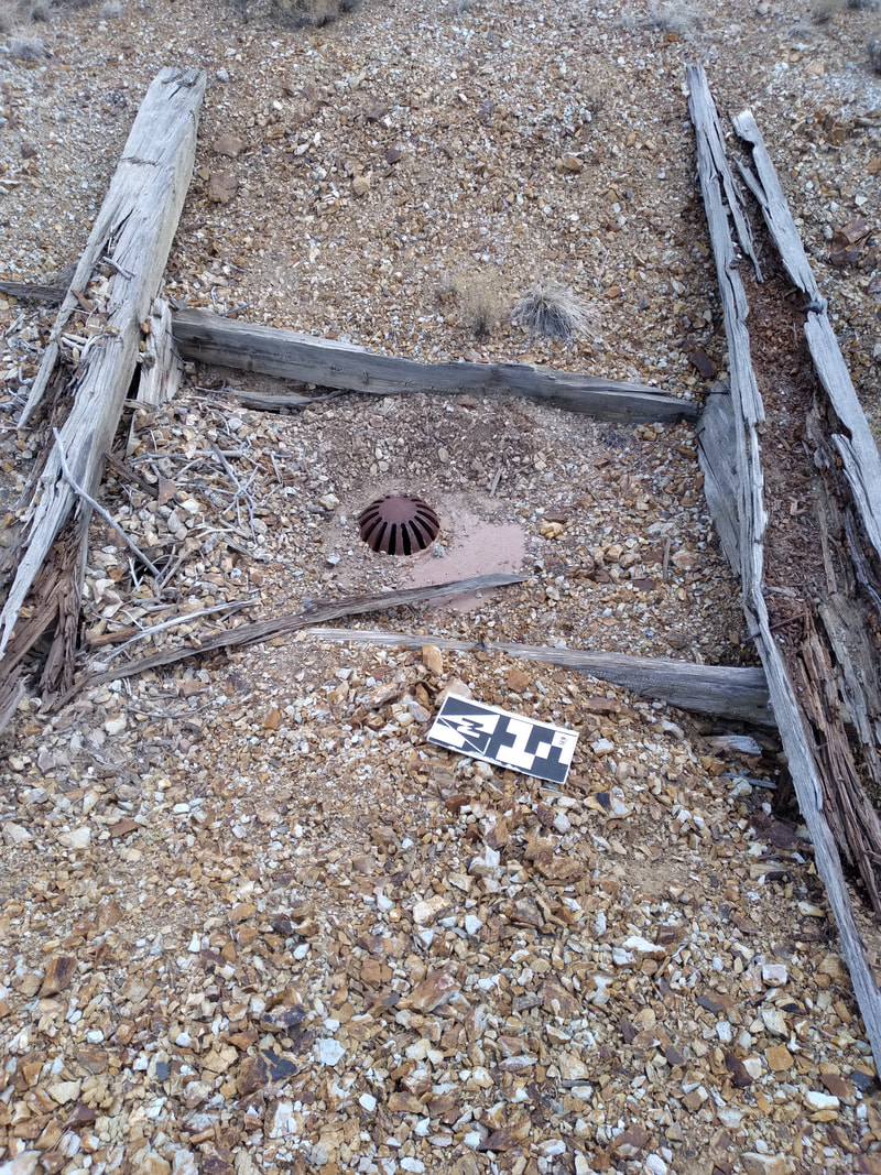
Welcome to our 1st edition of Annette's Adventures! This monthly blog follows our field scientist Annette Sunda as she explores the vast lands of New Mexico while working our AML monitoring program! Hope you enjoy! Hello, and welcome to my new blog and my new job! My name is Annette Sunda and I recently started working with GEM Environmental, monitoring closed mines on Abandoned Mine Land (AML) in the Land of Enchantment. As enchanting as New Mexico is, it should be called the Land of Adventure. The adventures have not stopped since I moved here, in fact, I think they have doubled since I started AML monitoring and I want to take you along for the adventure! My introduction to AML monitoring starts in the Cerrillos Hills Mining District, which is roughly 20 minutes south of Santa Fe, on Highway 14 aka “The Turquoise Trail”. Follow the signs to Los Cerrillos and take a pit stop in the village to enjoy the shops and mining museum. Once you are done checking out the town, head on over to the state park, this is where the adventure begins! My first day on the job was a bit of an unknown for me. I had my GPS device Trimble, called the “Yuma2” (it looks more like a tablet than a GPS device), I also had my trusty field shirt, a knit cap, and gloves to keep my fingers warm. I loaded my vest with lunch and snacks, put sunscreen on my face, grabbed my two-liter camelback, and off I went to see what I could find. The Yuma2 tells me the location of all closed (remediated) mines in the area, and it is my job to make sure that I can locate and verify that they are still in good, remediated condition. So I started up the trail and quickly decided that trail was too easy to walk so I jumped down and started hiking, down the slope and up the next hill to the first green dot on the screen. Then off again, up the hill to two more dots, back down, and again up and over the next hill to some more remediated mine features. My entire first day was a series of spirals, narrowing in on the mine features and climbing up and down the steep hillsides in the blowing wind and shining sun. It was a long day, but very glorious. I managed to reach nine mine features that day, all were far off the beaten path and in good condition. When I was finally too tired to think, I headed back to the car. Exhausted, tired, and looking for the quickest way back, I found what looked like a cow trail, and I thought to myself, “cows go home, and so do I”! So I followed the trail and quickly realized it was not a cow trail, “that’s a shod hoof, this is a horse trail” I probably yelled that out loud. Five minutes later I was back at the main trail and two minutes after that I was back at my car. Day two and day three were much more of the same, except I stuck to the trails and was able to get to more mine features. The cool thing about Cerrillos Hills State Park is that the main trails wander throughout the hills and take you to a lot of the mine features. Most of the mines on the state park trails have interpretive signs and I would encourage all of you to check out the trails and see how industrious the local miners were. During my third day at Cerrillos Hills I stuck to the west side of the main access road and saw some very cool mine closures, the coolest mines were right next to the trails and still had the original wooden headframes in the mine shafts. One remediated mine shaft has a bridge that crosses over the opening and has a great view of the very deep hole. By the end of this day, I had seen all the remediated shafts that I could reach from state park trails, so I reached out to the local property owners and received permission to access mine features on their land. The property owner told me that there were some really old mines on his property and that I would enjoy seeing all the closures. He was not wrong. As it turned out the very next day my meetings were canceled so I loaded my gear and headed back to Cerrillos Hills....  I went through the private property gate and on to my first stop. Mina Del Tiro, the oldest recorded mine in North America! A large shaft, roughly 20 feet square with a concrete “collar” around the top and “mesh” stretched across the opening. My fourth day was a cold, windy, rainy day; I compromised by monitoring mines that could be easily accessed with my car. I wandered around the roads on his property to see what points I could reach. In addition to Mina Del Tiro, I also found my first “Bat Coppola” a large metal structure on top of a closed mine shaft that is designed to allow bats to easily enter and exit the shaft. The last shaft of my day was possibly the coolest thing I have seen so far, a stub shaft with a vein of turquoise in the sidewall. With the weather turning to rain just after marking the turquoise shaft, I hopped back into my car and headed home. Seeing the oldest recorded metal mine is cool and not easy to do unless you have the right connections but seeing turquoise in bedrock staring me in the face was definitely a lifetime goal achieved. Thank you GEM for the great adventures! I look forward to sharing more adventures with you throughout the summer field season. Make sure to check back monthly for more of Annette's Adventures! And be sure to follow us on Facebook!
 GEM Environmental is excited to welcome one of our new members to the team. Annette Sunda is our new AML Monitoring Technician! Annette currently calls the Land of Enchantment (aka New Mexico) home, but she has also lived in Arizona, California, and Washington State. She feels that most people who know her will tell you that her main interests are playing with sand and swimming, however, she would like to think that her interests are much more diverse. Annette enjoys exploring, paddle boarding, camping and hiking, along with gardening, quilting, and experimenting with recipes. She has always been fascinated with science. Growing up in the outdoors, she was extremely curious about everything around her. This led to her firm belief that “an education steeped in STEM gives us the tools to understand the natural and not so natural world around us: Math is the language that connects us, Engineering gives us the reason to solves our problems, Technology is ubiquitous in our everyday life and Science teaches us to focus and harness curiosity”. Welcome to the team, Annette!  How did you hear about this service opportunity? For the last four or five years, I have been on the sidelines of GEM, always watching in amazement at the great things being done and helping where I can. I heard about this opportunity when it was in its infancy and was excited that this was an opportunity that would put my diverse skills to work. Please provide a brief description highlighting your work/area of focus. My main research focus through college was investigating sand and how it moves across the Navajo Nation with specific attention given to composition and grain size sorting as a factor of transport height above ground. What do you plan to accomplish during your service term with GEM? As much as I possibly can! To quote Norman Vincent Peale “Shoot for the moon. Even if you miss, you’ll land among the stars.” 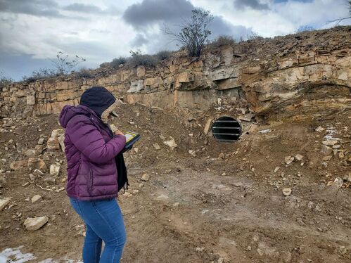 What are your career goals?
As a total fangirl of GEM, I can easily say that my career goal is long term growth with GEM and helping expand operations in New Mexico. Do you plan to continue your education? If so, what programs or school are you looking into and what is the highest degree you plan to earn? I like to consider myself a lifelong learner. It took me ten years to finish my Associate of Art another five years to complete my Bachelor of Science and three more years to achieve my Master of Science in Computer Science. I believe eventually I will work toward a Doctoral degree, however, at this time in my life I am satisfied with learning for fun. I believe in a year or two I will be back in community college courses learning something new. Have you had any other internship or service opportunities before this? If so, how do you believe internships have benefited you so far? I started participating in internship programs while working on my undergraduate degree. I have completed a total of four internship programs: Project Accesso at CSU Channel Islands, Jack Kent Cooke Bridges at UCSB, NAU/NASA Space Grant, and the Pathways Internship program at the U.S. Geologic Survey Astrogeology Science Center. Each internship program had a unique focus, from learning valuable data collection and analysis skills to learning how to effectively communicate complicated science problems to the average person. I would encourage every student, regardless of their focus, to apply to as many internship opportunities as possible. To learn more about Annette check out her profile: https://www.linkedin.com/in/annettesunda/ |
Categories
All
Archives
June 2024
|


 RSS Feed
G.E.M. Environmental NFP
Geology - Engineering - Minerals - Environmental - Not for Profit
Geology - Engineering - Minerals - Environmental - Not for Profit

|
Community Partners
|
Programs
|
Get Involved
|
About
|
Follow Us
|
Sponsors & Donors
|
© COPYRIGHT 2017 - 2023. ALL RIGHTS RESERVED. G.E.M. Environmental NFP
GEM Environmental, GEM4STEM, GEM Corps, and Charity Rocks are all Registered Trademarks of G.E.M. Environmental NFP.
Any and all use of Trademarks or Copyrights must be authorized.
GEM Environmental, GEM4STEM, GEM Corps, and Charity Rocks are all Registered Trademarks of G.E.M. Environmental NFP.
Any and all use of Trademarks or Copyrights must be authorized.
|
|