|
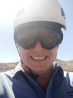
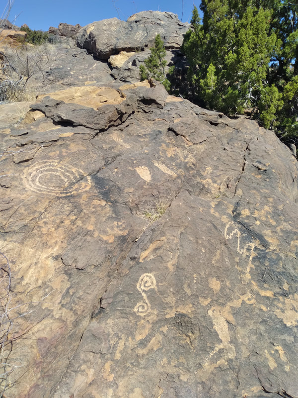
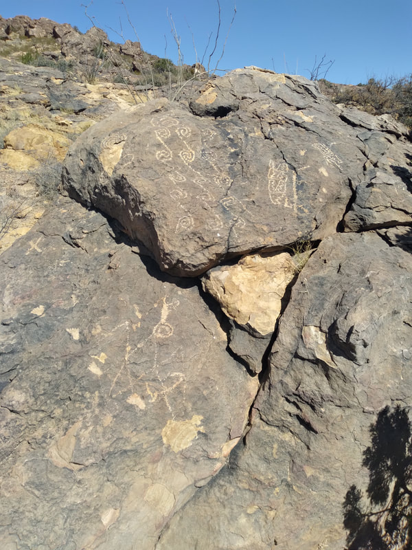
Hi Folks! Welcome to a long-overdue episode of Annette's Adventures! I've been working in the Cookes Peak Mining District, located northeast of Deming, NM. The mining district encompasses three historic mining camps, Hadley Town, Cookes Town, and Jose Town. It is situated in Cookes Range, a rugged and remote mountain range centered around Cookes peak, which towers above the surrounding desert at 8,408 feet. My introduction to Cookes was one that I am not likely to forget but will reserve for another day. The results of such an introduction allowed me to meet the locals and learn the local lore and the routes they use to get around the region One of such opportunities was a trip to Fort Cummings to show me the eastern entrance to Cookes Canyon, at which time I was told the canyon was the "Original 'Masacare Canyon'" and that this was the route that I should take to get to my field area. I would need to find the western entrance to the canyon. Following my guided tour of the region, I found out that the west entrance to the canyon was the first left after the second cattle guard. I immediately set out to find the west side of the canyon and travel through the canyon to the old spring house. The first day after my introduction to the area, I took an off-road trail from the RV through a dry wash to a dirt road. I follow the dirt road to a secondary road that leads me to the canyon pass. On my first trip along this route, I noticed a small sign designating a parking spot in a seemingly odd location. I drove past the parking spot a small distance and saw large panels of petroglyphs on the hillside. I quickly realized that the parking spot was for the petroglyphs, so I backed down the road, parked LadyBug, and scampered up the hill to the petroglyphs. Standing on the hillside next to the petroglyphs put me in a state of awe. I looked around the surrounding area and thought about those there first and the type of life they might have lived. After my awe-inspiring moments taking in the petroglyphs, I scrambled back down to LadyBug and continued my journey along the route. The road skirts around the valley floor from the petroglyphs. It climbs above the valley, passes through a saddle, and follows a gorge out the other side through a narrow valley to Fort Cumings. Once at the fort, I went to the spring house and read the plaque designating the spring as a part of the original Mormon battalion route and later the Butterfield stage route. I explored the few remaining buildings near the spring before returning through Cookes Canyon back to camp. As I drove back through the pass, I felt the eyes of hundreds of Indians staring at me from the surrounding ridges. I kept a watchful eye on the hills, but the only silhouettes I saw were rocks and bushes. That first trip through Cookes Canyon ignited my curiosity about the area's history, and I started listening to the stories of longtime residents. One person told me that naturally occurring lead contaminated the Cookes town spring and that if you visited the cemetery, you would notice a substantial amount of children. The storyteller continued to tell me that occasionally one of the miners would succumb to the lead poisoning and go on a rampage through town. Cookes Spring was named for Captain Phillip St George Cooke 2nd U.S. Dragoons, former commander of the Mormon Battalion whose forward scouts discovered the spring in 1846. The spring was the only freshwater supply between Mesilla and the Mimbres River, and the nearby pass became a popular overland route. By 1858 the spring and nearby pass became part of the Butterfield Overland Route and an established mail station. The mail station became Fort Cumings in 1863 and closed in 1873. The fort was again used from 1880 to 1886 as a camp during operations against the Apache. At the height of operations, Fort Cumings included a parade ground, corral, and several adobe buildings that were all encompassed in a 10-foot tall adobe wall. At the time, this was the only walled fort in New Mexico. Amazingly the spring house stands intact after all these years, but all that remains of the fort is some walls melting back into the desert and a graveyard. One book I found recounting stories from Fort Cumings described Cookes Canyon as a"'journey of death'" six miles or more in length and a gloomy gorge of four miles to add to its terrors." The author continues, "The tales of this gorge in the sixties where so many massacres were perpetrated by the Indians were gruesome enough." One such incident is the 'Battle of Cookes Canyon,' which tells of the Acke Party, a large group of refugees from Arizona heading east to Mesilla. As the last wagon entered the canyon, approximately 100 Apaches ambushed the group. The last wagon in the group was able to flee and returned to Mimbres, where they sent a plea for help from the Arizona Guards stationed at Pinos Altos. The ambush took the lives of 4 individuals and wounded many more. This incident sparked a series of skirmishes between the settlers and the Apache. One account says that the Arizona Gaurd recovered some cattle, and the sheep were later found in a side canyon not too far from the fighting. I've safely passed through Cookes Canyon many times to Cookes Peak. Each time I pass through, I am struck by the beauty and the ruggedness of the terrain. I imagine life in the west during the pioneer days, and the thought of traveling this route with a wagon instills me with great respect for the pioneers of the old southwest and the Apache that came before. Until next time readers, thank you for joining another one of my adventures! ***Annette is a trained and experienced Field Geologist. Please be cautious and always keep out of any abandoned mining area. Safety First!***
|
Categories
All
Archives
June 2024
|
G.E.M. Environmental NFP
Geology - Engineering - Minerals - Environmental - Not for Profit
Geology - Engineering - Minerals - Environmental - Not for Profit
Community Partners
|
Programs
|
Get Involved
|
About
|
Follow Us
|
Sponsors & Donors
|
© COPYRIGHT 2017 - 2023. ALL RIGHTS RESERVED. G.E.M. Environmental NFP
GEM Environmental, GEM4STEM, GEM Corps, and Charity Rocks are all Registered Trademarks of G.E.M. Environmental NFP.
Any and all use of Trademarks or Copyrights must be authorized.
GEM Environmental, GEM4STEM, GEM Corps, and Charity Rocks are all Registered Trademarks of G.E.M. Environmental NFP.
Any and all use of Trademarks or Copyrights must be authorized.


 RSS Feed


